Mt. Massive

Crossing South Willow Creek, appx. 0630 in the morning on the day of the hike.
I was beginning to wonder if I would attempt another 14er this year and finally made myself go for it. Since I had done Elbert a couple of years earlier I thought it a good idea to close the loop, so to speak, with its neighbor, Mt. Massive. I also had the luxury of talking with a co-worker (Curt Child) about the trailhead, areas to camp, etc. since he and his family and just finished a weekend trip in the same area. In fact, he and his oldest daughter hiked Elbert the same weekend.
So after clearing things with Becky and work I set off. I first broke out my checklist (a must!) before packing to ensure I had everything I needed. After loading up I set off around 3:30 on Tuesday, 9 Aug. I decided to forgo Hwy 24 and take I-70 since Curt said this way was quicker. Shortly after leaving the Denver area the clouds opened up and it began to rain, not to really quit until just before existing I-70 for Leadville. I did make a brief stop at Idaho Springs at McD's for a quick bite. A very nice McD's, as far as McD's go.
After arriving at Leadville, I stopped at the Safeway and picked up a few last minute things. From there I headed south of town towards the trailhead. Everything was just like Curt and Gerry Roach (author of the 14er book I use) said it was and I made it to the trailhead about 7 p.m. I saw several federal campgrounds but didn't to pay $10 for a campsite and a vault toilet so I headed on down the road (which gets progressively worse but is still passable) for about a 1/2 mile. I found a good spot with plenty of room and close to running water (helps me sleep). One thing I purposely did different with this hike was ensure I was tired, at least more than usual. I made my self stay up late the night before leaving and I got up a bit earlier. May not sound like much but it did ensure I slept well while camping.
After setting up camp and ensuring everything was were it was supposed to be, I zipped myself in my tent and settled in. In addition to my hiking lamp, I also brought our small camping lantern (which I need to get one of so I don't forget to put it back). For reading I brought my Bible and a Tom Clancy novel (Red Storm Rising). I was already feeling quite sleepy but there was still some daylight so I resisted the urge to laydown. Finally, around 9 I did turn off the light and go to sleep.
After getting a good nights sleep, I woke up at 0430, quickly broke camp and headed to the trailhead. For breakfast I had poptarts and a cup of coffee. I was the first car to arrive and heated my water for coffee there as supposed to my camp site. I loaded up and began heading north at appx. 0545. According to Roach I would arrive at the South Willow creek within 2.4 miles, the North Willow creek within 3 miles and the junction at the 3.3 mile mark. My unofficial goal as to make the junction within an hour, which I more or less did.

At the junction. The Massive trailhead is to the left (south) and to the right (north) continues the Colorado Trail. This point is 3.3 miles from the trailhead (appx. 7 a.m.)
From this point I now headed west and quickly ascended above tree line. The trail was very well marked and the footing was nice. I also passed a young couple just before this point and did not see them until I returned to the trailhead.

Not sure why this cairn was here because the trail is almost idiot proof (at least at this altitude).
Once above this point I started the obvious quest for more oxygen. While my physical conditioning is better than it has been in years, I never do any real training at this altitude.
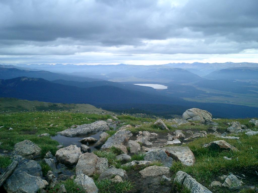
A small alpine lake, appx. 13,000 ft. Notice Turquoise Lake near the top of the screen.

Here I am just below the summit. The sign reads "Closed For Renovation." I'm assuming this is for the Half-Moon trail which I contemplated taking. I believe this portion of the trail is still open but is discouraged.
From this point I had appx. about 1/2 mile to ascend and appx. a couple 100 feet of elevation. Unfortunately the trail is a little murky from this point but is definitely achiveable.

At the summit, the picture was taken by a man I met after reaching the top. He and his friends were from out of town (Maryland?) and were staying in BV and were doing several 14ers during their stay. He had only departed about 30 minutes after I did and caught up with me quite quickly. After we spoke for a few minutes I decided to head down. Also, while we were at the summit, the clouds rolled in (and then out) very quickly. Quite a sight to see, being essentially eyeball-to-eyeball with the clouds.
The trek down was relatively easy. I did come across quite a few people and the common question was "How much farther?" and "Will the weather hold". As for the weather, I told them all not to be concerned with the clouds since they were moving in and out rather quickly. Lightning, on the other hand ...
One small boy I spoke with was quite funny. His question was how much longer, not farther. I told him it depended on how fast. He didn't seem to understand but his father did use this diversion as an illustration that the more he stopped the longer it would take.
Approaching the junction.

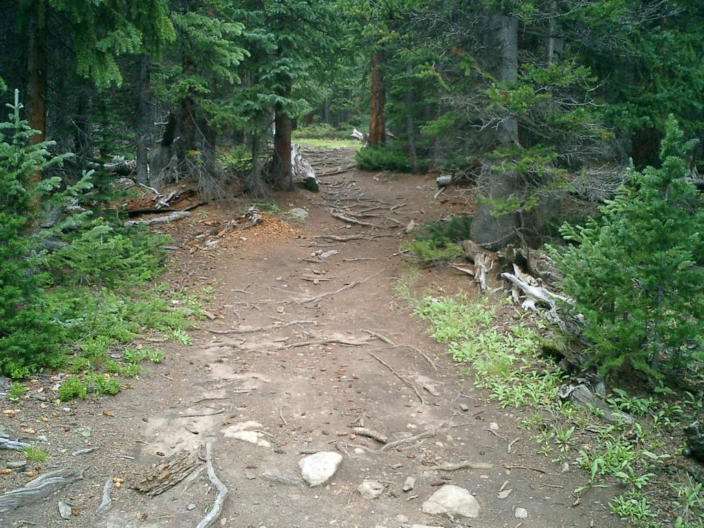
Approximately 1 mile from the trailhead.
